Apples and Oranges: A weekend in the Eastern Sierra
For the 3rd time in 3 weeks, diet I woke up at midnight to go climb a big mountain. The motions have taken on a faint sense of familiarity, web a sort of deja vu. An empty house, roomates out at the bars, loaded backpack waiting by the door, laden with dual ice axes and my boots and gaiters sitting peacefully by its side, begging to be dawned and trodden through the snow and ice, over the high alpine rock. The tools of the trade. My food bag sits in the fridge, each of the 3500 calories ready to be burned.

Peanut butter and Nutella sandwiches, sesame-honey bars, yogurt covered goji berries, almonds, energy gu, snickers, payday bars (my favorite), and 2 apples mang, Fuji of course. I throw it all in my car and start driving to North Boulder where I will meet up with John and Josh at John's house at 12:45am. My windows are rolled down as I drive, the cool evening air getting cooler, waking me up from my awkward 3 hours of sleep, clearing my head. All around me are familiar faces, wide-eyed and drunk from the evening's entertainment, lovers holding hands, groups of men stumbling home, beer-stenched, unsuccessful in their hunt for a bed companion, a couch companion, someone to wake up with, something to tell their buddies about. For a split second I envy all these night-owls, such an easy persuit, empty bottles in hand, and blurry people all around, but the urge for urban wandering fades quickly as my objective moves to the forefront of my consciousness. A mass of rock and snow somewhere in the far distance, unseen for the time being, immense and prodigal under starlight, waiting for the mortals to show up for their daily assault, Don Quixotes all of them. I am one of those mortals, clad in gore-tex armor, swinging my axe at frozen dragons in the name of something not yet realized, hoping not to be forgotten, doomed to that very fate by endless time and its unforgiving ability to roll everything over. So here I write my stories, let the words unravel on a glowing screen and with the click of a button, send them on their way, riding light waves a million times around the globe in a day, riding and riding until there is no more light to ride. Will my stories die with a bang, or will they fizzle away in the vacuum of space, infinitely dispersed? Or will my stories crumble like the very rock they are conceived upon? The 3 of us raced North out of Boulder in Josh's Toyota pickup, I sat awkwardly on the hard bench seat in the back of the cab, trying to pour hot coffee from my canteen into its top which unscrews to become a little cup...brilliant I had been awake for over an hour, but my senses were now being hightened by that magical ambrosia we call coffee, lifelong friend of the mountaineer, a deeply woven thread in the history of peak scaling and ocean sailing, coaxing the sleep deprived to greatness since its bean was first introduced to hot water. This particular coffee was extra befitting of my current adventure. I had gone to see Jennifer Lowe-Anker present her new book, Forget Me Not, at Neptune Mountaineering the previous Thursday and at the end of the show, Gary Neptune asked some random trivia questions pertaining to the presentation. I was the first to shout out the answer to his last question, which was about a climb Jenny had done in Yosemite. My reward for paying attention was a bag of Summit Coffee, whose "climber series" benefits the Alex Lowe Charitable Foundation. Alex Lowe being an iconic Colorado mountaineer, who probably climbed the very route we were going to do. This particular coffee was "the Fiend blend." The package proclaims its flavor as "strong, bold & impressionable." An accurate description.


 The final section to the summit plateau involved about 150 feet of 5.4ish rock which had some wet sections. John lead this section flawlessly and with healthy runout, then belayed Josh and myself up.From there it was another 150 feet of 4th class rock and some snow patches to the summit.

 I am glad we all survived. I will be stoked to mix it up next week. This session certainly defined the word punishment for me.
P=G
Circuit #1
One Arm Alternating Kettle Bell (35lbs) swings x 30 Standing Sled Pull (50lbs) for 100′ Thrusters with Kettle Bell (35lbs) x 15 "Flesh Storm” - one run: ~ 400′
Circuit #2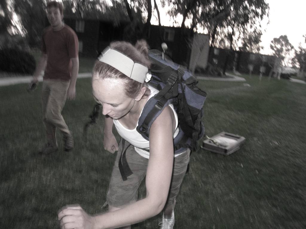
Clean and Jerk (115lbs) x 10 Kneeling Ab Roller x 15 Burpees x 10 Heavy Bucket Carry for ~400′
Circuit #3
22″ Box Jumps x 20 Tire Flip (330lbs) x 15 Pushups x 15 Spin the Biscuit (20lbs) x 20.
Results:
| Round 1 | Round 2 | |||||
| Circuit 1 | Circuit 2 | Circuit 3 | Circuit 1 | Circuit 2 | Circuit 3 | |
| Nate | 2:30 | 2:38 | 1:54 | Puss | Puss | Puss |
| Charles | 2:23 | 1:34 | 1:49 | 2:23 | 2:58 | 2:00 |
| Alex | 2:39 | 2:22 | 3:01 | 3:04 | 2:33 | 2:42 |
| Shay | 2:23 | 2:06 | 1:54 | 2:47 | 2:40 | 2:03 |
| Lin | 3:25 | 2:34 | 2:22 | 3:25 | 2:46 | 2:32 |
| Jason | 2:43 | 2:36 | 2:48 | P | P | P |
| Kostas | 2:21 | 2:32 | 1:55 | 2:54 | 3:14 | 2:45 |
| Reid | 2:44 | 2:10 | 2:27 | 2:29 | 2:34 | 2:32 |
Notes:
Lin: 10 tire flips, decease 75lb cleans, 26lb KB Shay: 95 lb C & J Jason: 95 lb C & J Alex: 95 lb C & J
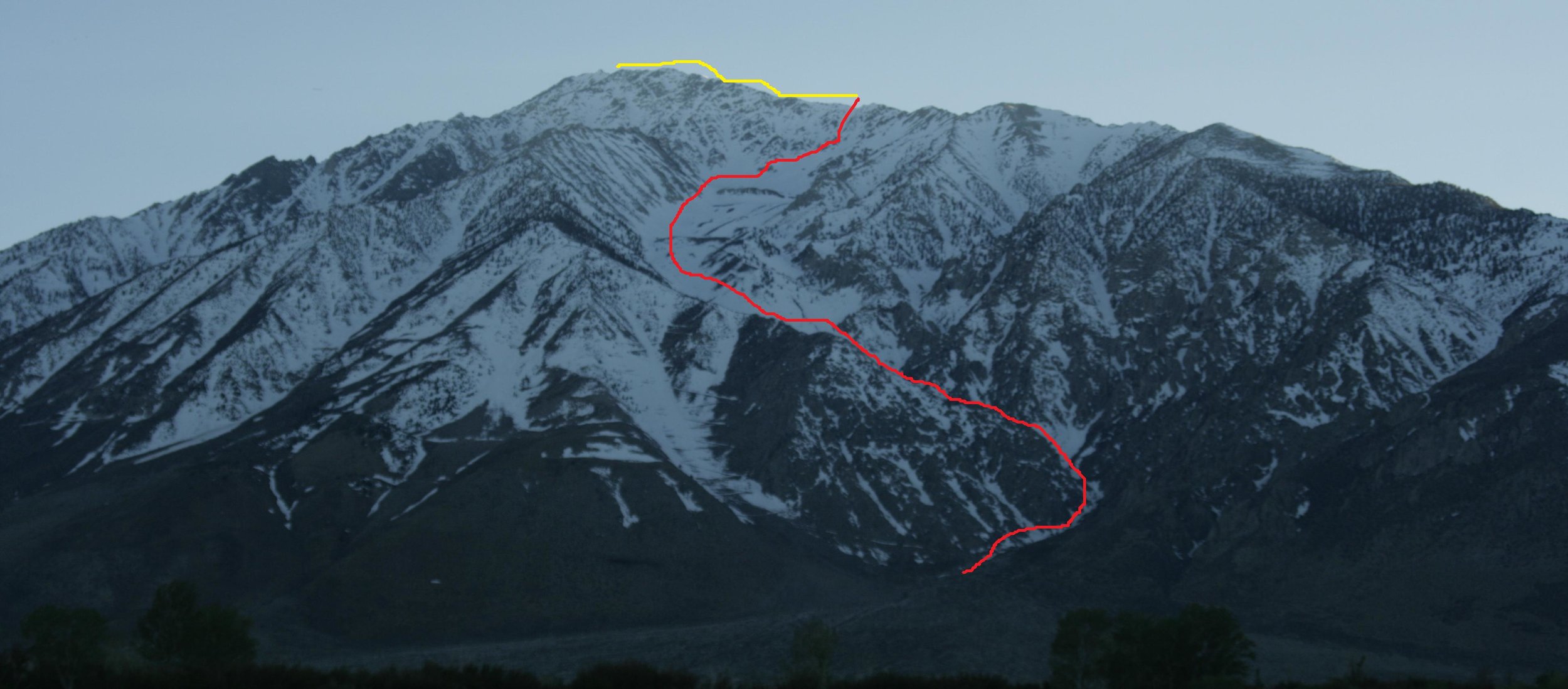
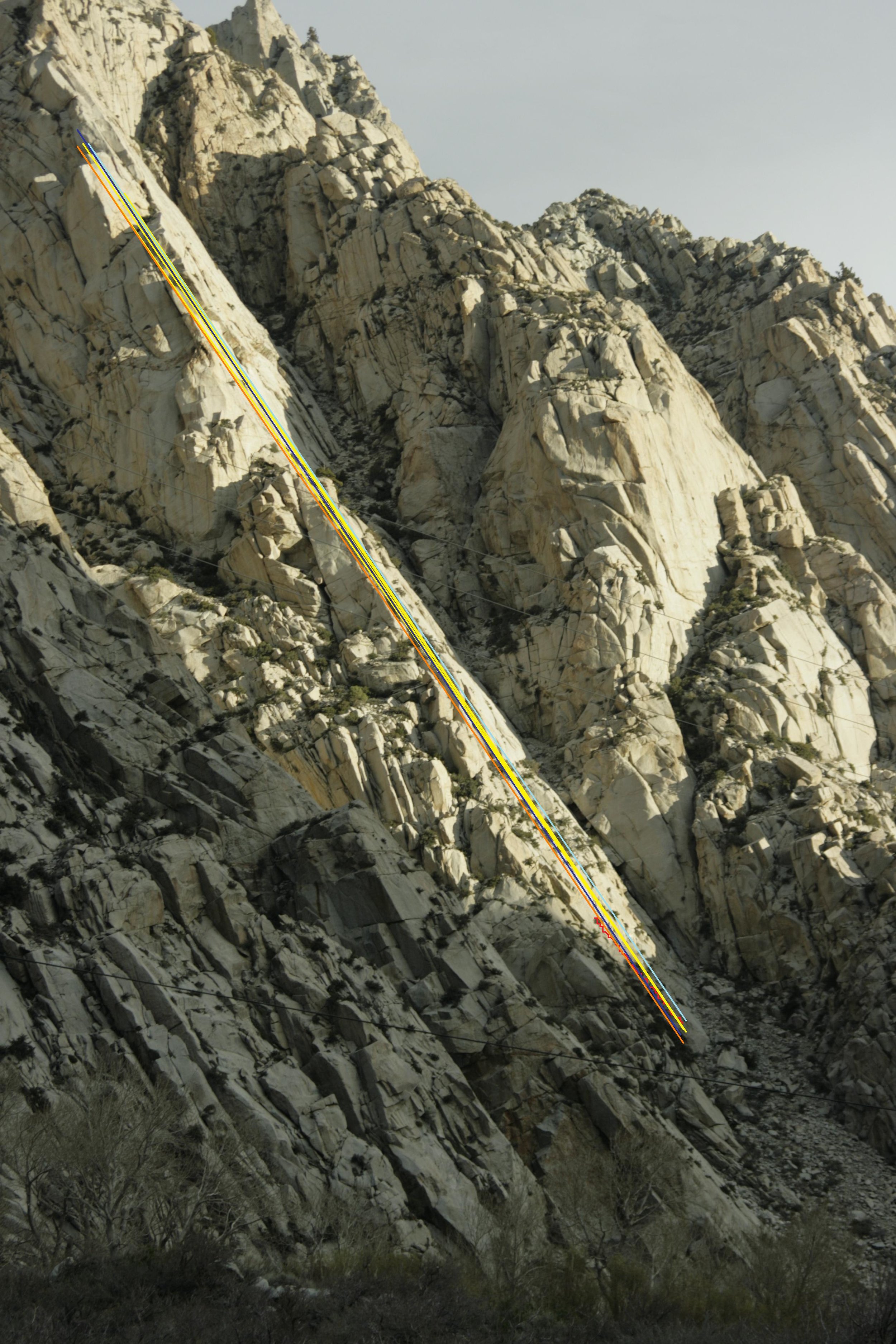
[gallery=52] Mt. Tom, stuff a behemoth amongst behemoths. It is one of the 3 iconic peaks that define the western skyline as seen from the areas around Bishop. The other 2 are Basin Mt. and Mt. Humphreys. Mt. Tom sit’s the closest to the highway, and therefore looks to be the tallest, although Humphreys is several hundred feet higher. Its wide eastern canyons hold snow much of the year, often all the way down to 5000 feet. This makes it perfect for backcountry skiing.

Elderberry Canyon can be seen from 395. It is the prominent canyon that descends to the northeast. Its serpentine shape and tremendous size make it an incredible ski area, with bowls, technical shoots, cliffs, and many drop in points. The general route is to go up Ellderberry canyon until you are in the collasal cirque formed where the North ridge and the Eastern ridge meet. Ascending any one of the headwalls below the endless North ridge will put you in position for a steep 600-900 foot drop to the cirque, with the steepness increasing as you near the summit. Then it’s endless open terrain until the very end where the snow peters out. (red line indicates snow ascent/descent, yellow indicates ridge traverse).
I drove up the old mining road on Friday evening after a day of bouldering in the buttermilks. The dirt road once led to a Tungsten mine on the mountain, it is not maintained. It switches back right up the face of the mountain…one of those roads in the Sierra you see from 395 and wonder where it goes. It is scary to drive on, but fun once its over. This road deteriorates and ends at around 6500 ft. There is not a single flat space to sleep, so I did a little creative rock placement in order to level my car. There was still about 2 hours of daylight and I had a relatively restful day, so I hiked up the canyon to where the snow became substantial, and cached my snowboard, boots, helmet, and some water.
I woke up the next morning, and started hiking at 8am, with just my food, super light Camp ice axe, and more water. What had taken me 50 min the night before to haul up my gear, took me only 25 in the morning and was far more pleasant. It was chilly in the shade of the huge walls, but that would change as soon as the sun began its long beat-down of Elderberry Canyon. Elderberry means “old berry” I think.
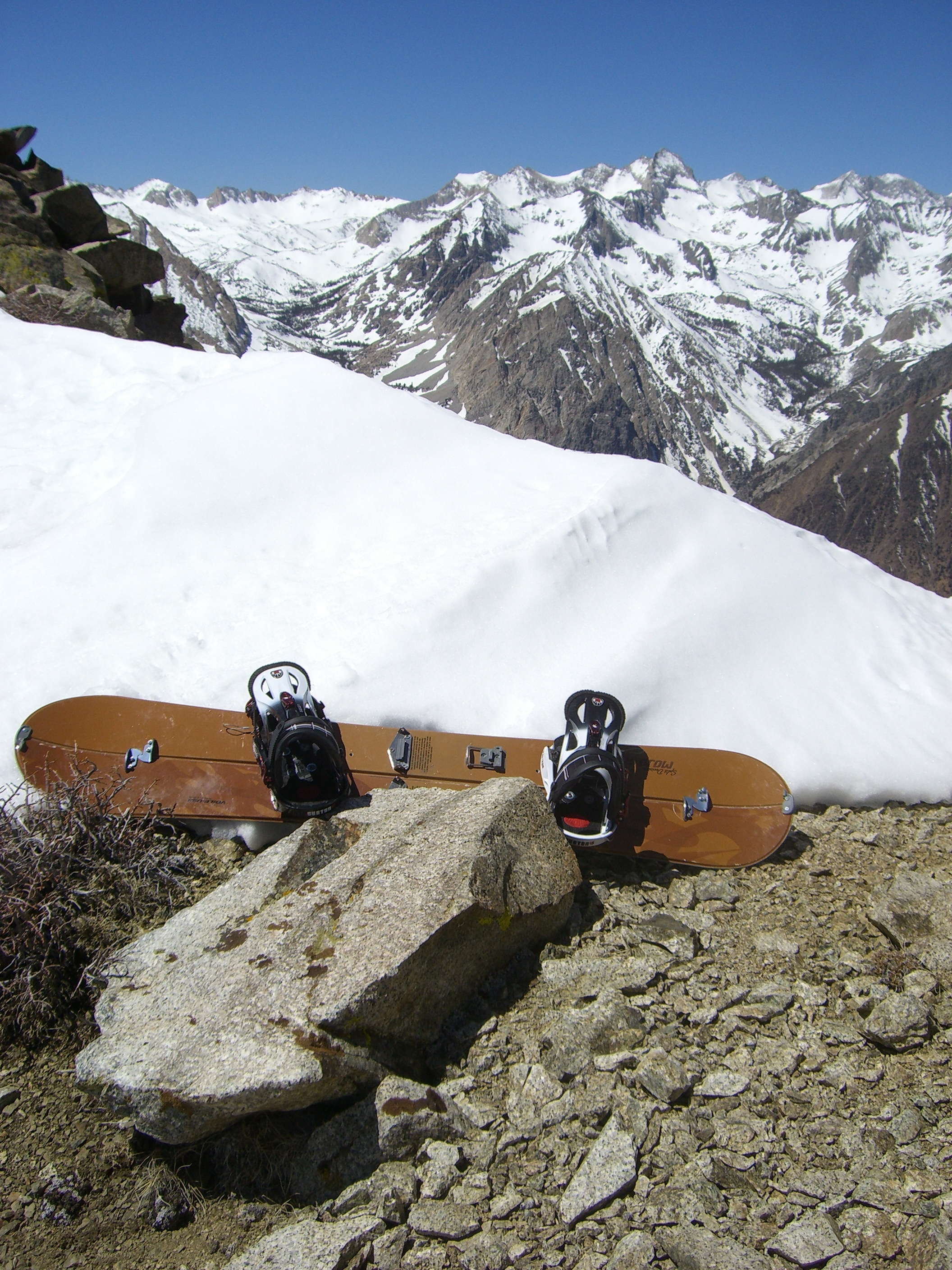
I put on my boots and split board, and put my trail runners in my bag. I had kicked steps the night before through some snow, so I could use my trail runners in the morning when it was icier, this proved to be crucial in letting me navigate the ridge to the summit after I topped out the snow. The snow was hard packed and often icy for roughly 4500 feet. I decided to crest the North ridge at around 12000 feet. I stashed my snowboard gear in a protected spot on the ridge and began to make for the summit in my trail runners at 1130am. I figured it would take me 45 minutes each way. One our and several false summits later, the sun was beginning to take its tole. I had already sucked down 80 ounces of water on the way up, but I was pretty parched. It took me 90 minutes to reach the summit after ditching my board, and one hour to get back.
The ridge running is very loose tallus of varying size. At some points, short 4th sections are encountered if you stay on the ridge proper The drop off to the east was covered in snow, so when I wanted to skirt a tower, I stuck to the West side of the ridge which was generally clear of snow. I did not carry the ice axe along the ridge. I reached the summit at 1pm, after 5 hours of skinning and scrambling up, a little over 7000 ft.
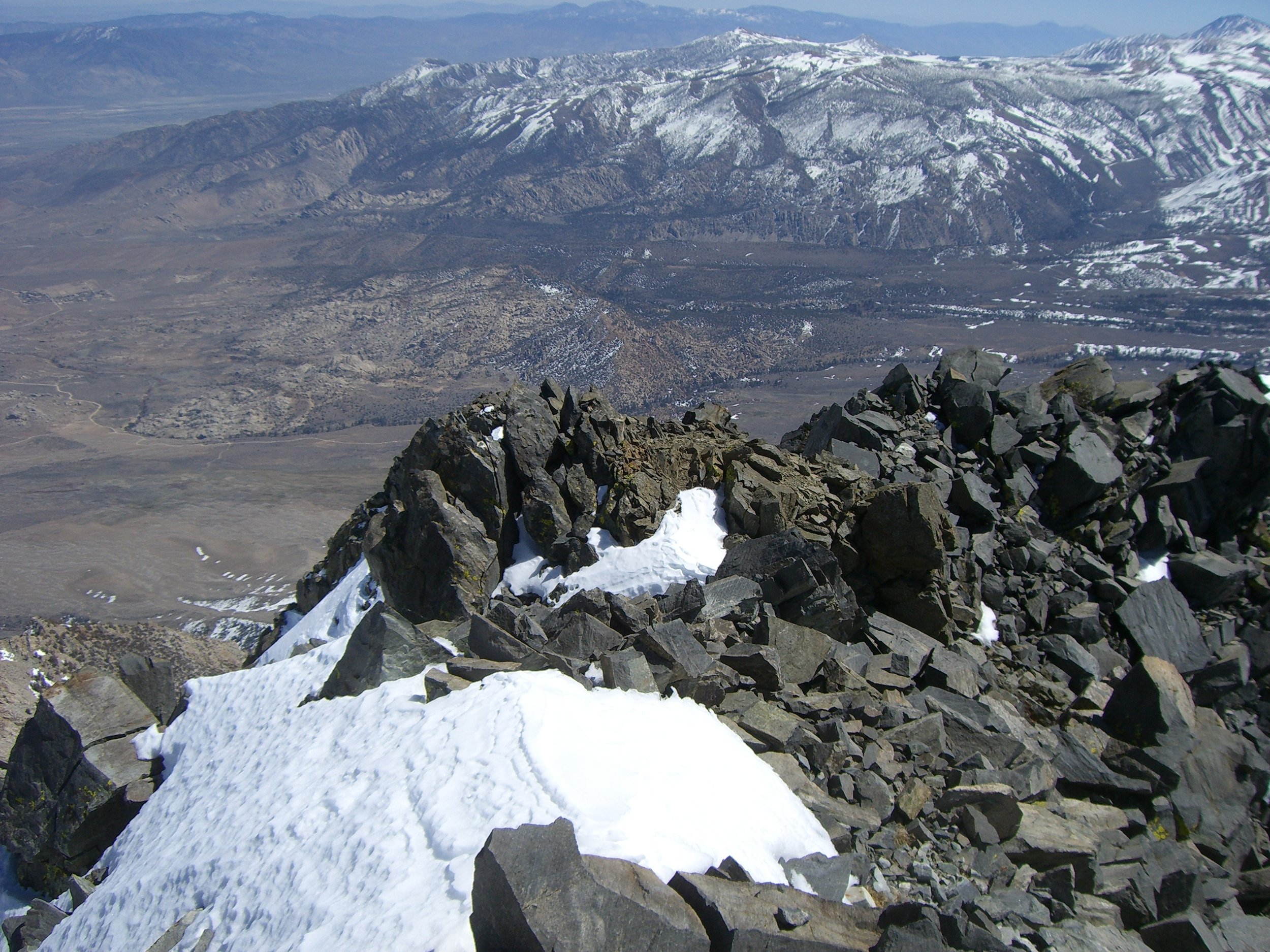
The summit (13,652 ft) itself is not special, just the highest point along an impressive ridge, but the view it commands is stunning. The drop off to the cirque below is steep, but still holds snow. Beyond that, the Owens valley sits dry and calm. Coming over the North ridge and seeing the span of the Sierra to the west jump into view is truly awesome. The realization that this massive mountain is only a gateway to a vast land of giants, becomes endlessly clear. By the time I got back down the ridge to my snowboard, my legs and ankles were pretty banged up from all the loose tallus. I was happy the high impact stuff was over, and ready to slide.

I had been told by some locals the day before that the snow in Elderberry canyon was crappy at the present time, but they must have been stoned, or maybe they were just skiers. The snow softened up to a slushy consistency under the baking sun. Too soft to walk in with just boots, but perfect for my wide snowboard. There were also many sections of better packed snow on which I could gain some speed. The canyon is huge, and the terain is sprawling. After the initial 40 degree drop, the canyon offers diverse terrain from natural half pipes and bowls, to wide open steep faces, with plenty of plateaus to take a rest. In a heavy snow year, this mountain can rival many large resorts. But I was the only one on the mountain all day, and it cost zero dollars.
About ¾ miles before I reached the car, my board broke through some snow into a running stream. The icy water actually felt good after descending 7000 ft. into 80 degree weather with my shell and helmet on. I strapped by board to my backpack and bushwhacked through prickly bush the rest of the way back to my car in my snowboard boots. I got to the car at 410pm and ate an apple, mang.
That night I drove down the sketchy road before it got dark and headed west into Pine Canyon, which wraps around the base of the North ridge of Mt. Tom through the town of Rovana and deeper into the sierra. I had climbed with a local, Dan, on Cardinal pinacle 2 days earlier. He swore there was more rock in Pine Canyon alone, than in Yosemite. Pine canyon emerges from the drainage that separates Mt. Tom and the Wheeler Crest. The Wheeler Crest’s eastern wall stretches for several miles before it fades down into the Sherwin grade. The amount of long, multi-pitch routes that can be seen from the highway is unbelievable, but that is nothing compared to the amount of rock which lies within the canyon, where the Wheeler Crest disappears behind Mt. Tom.
Imagine the South Face of Lone Pine Peak, on steroids. The main difference is that the approach begins on the side of Pine Creek Road, and doesn’t involve bushwhacking through that hellish canyon. The walls continue upwards for several thousand feet, broken into soaring dihedrals, and towers of every shape and size. The only published climbs are in the Bishop area guidebook, which only covers some of the lower pitch stuff, and offers no gear information (a new one is supposedly coming out this year). The Pine Creek Canyon looks like a Red Rocks of granite. The Bishop area is one of the finest in the world for climbing, offering bouldering, to grade V rock, with incredible weather options and approachability.
Bill showed me the book on Sunday morning. I had woken up with no intention of doing anything but basking in the alpine glory I had attained the day before. I was going to sit next to Pine Creek and just look at the walls with my telescope all day. But Bill quickly convinced me we should climb a couple pitches since the weather was so nice. I agreed.
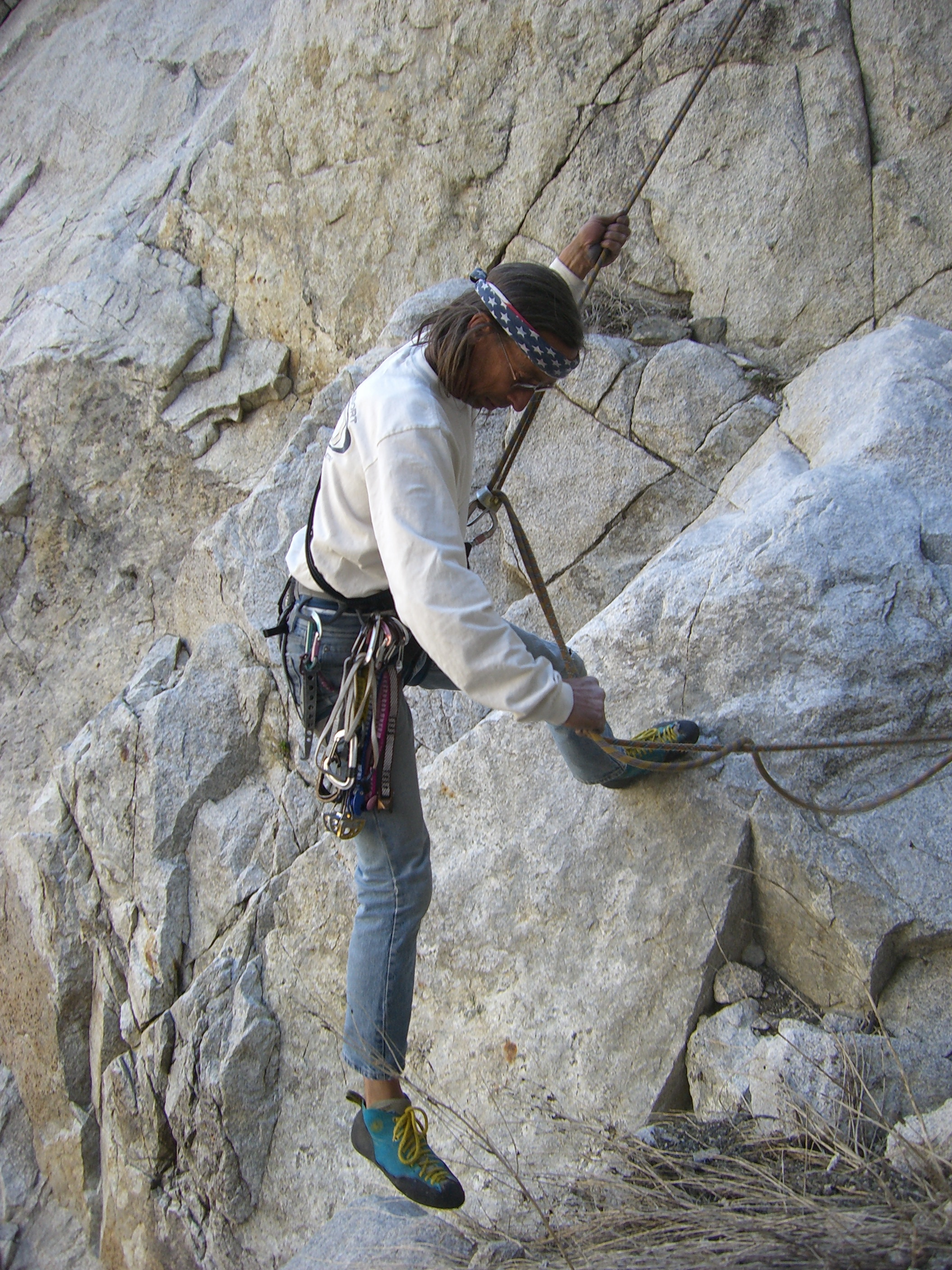
He said he’d been wanting to do this 5 pitch climb which ascended the Elderberry Butress, which has the same name as the canyon I had ridden down the day before. Bill didn’t tell me until we were at the base of the wall that there were 3 initial “low 5th” pitches to reach the base of the tower we were to climb. We soloed these which were very loose and involve some hard climbing, but little exposure. I lead the first pitch which felt really cruiser except when I reached for a finger sized hold to lierback a flake and the hold did not exist. I took a good 15 foot whipper on a new Master Cam, that I had placed for the first time, before Bill caught me a foot or so off a ledge. We swung leads all day, not following a particular route, but just heading for the top of the tower. Bill is an older hippie dude, with long gray hair, always back in a pony tale and kept under control by an American flag bandana. His gear is older than I am, so we used mine. He might be the hardest climber/Tom Petty look-alike I have ever climbed with.
All the pitches were incredible, save for the scaly rock on all the granite slab. The highlight for me was leading a 100 foot long crack/flake that was about a #6 size, but all I had was a #4. After a lot of cursing and bleeding, I reached a ledge and belayed up Bill who lead the next pitch up a system of perfect small hand cracks.
We climbed the route in 6 roped pitches, 3 unroped, and rappelled down with 3 double rope rappels which put us in a gully about 150 feet above where we started the whole climb and stashed our packs.
We talked for a while once we reached the packs. I pulled out an orange and said, “I’m going to eat my orange, mang.”